The Batu Arang Ultimate Direction. A trail running event around Batu Arang Heritage City located near Rawang with the offer of 3 distances, 27km, 55km and 83km. The run is a almost half mixture of tarmac road and the other half of jungle and dirt road. The race is not a full loop of 83km but instead it is a 3 lap race with each loop of 27km+. Unlike TMMT, the cut-off time for this race is a bit lenient with 19.5 hours to finish it. Though compare to TMMT, there way more more up and down hill with an elevation of 1800m+.
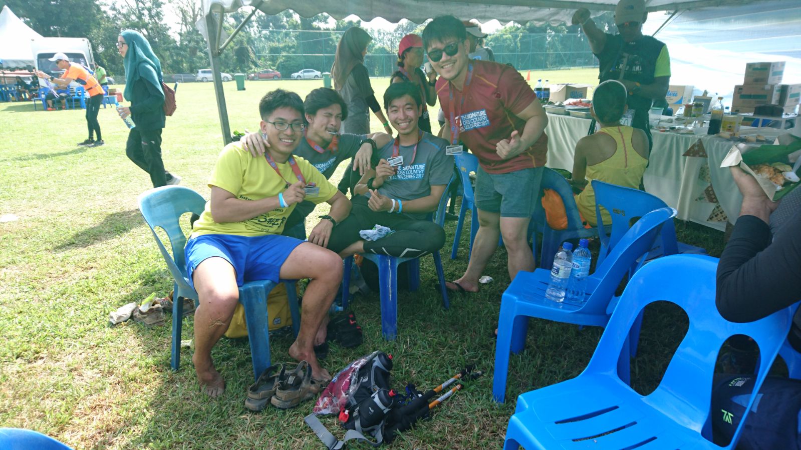
This time round, even though Quan did not join us, we had a very surprising member that were doing the same distance as us, Ang. He who I never expect to be in an ultra marathon as I only hike with him and never see him run a marathon (Note: he ran a full marathon two weeks before this race with a sub 6 timing, and that was his first full marathon in his life) MF, TF and CK was all there also. We all gather, took some picture and relax till the time come.
Around this time, I was in a much better condition compare to when I was in during TMMT 2017. Everything seem fine at the start, all I had to get use to probably the sleepless night ahead of me as this is my first time doing a run that will last throughout the night.
4pm, everyone start gathering in front of the finish line after a brief mandatory item check. You have your usual before-the-start speech and the countdown to the start. 4.08pm, everyone was release into the wild and the run begin. The start of the enormous distance, 83km to be done under 19.5 hours. The first 5km, everything was going as plan, maintaining a slow pace at the start of the race lead to one of the last few runner in the race.
Although the rest and many other runner was in front of me and far ahead by this time but I had a plan which I learn from TMMT 2017. It doesn't matter how fast you were at the start, if you can't endure all the way, you will still failed and so I maintain a steady pace and always keeping myself calm and avoiding the starting-line-adrenaline-rush-start. At the 7km and our first water station, I started noticing someone in front of me... It was CK! I did not believe I caught with him and then again I was right, he was having issue with his stomach which lead him to slow tremendously. We ran together for a while which after a while, I head on first and he wasn't far behind.
7km turn into 17km which is our third water station and where the sky were turning dark but I was still able to keep up a good pace which I wanted too and CK was still not far behind me. 20-21km into the race and the fourth water station, the sky has turn dark and the once a bright cheery forest has now turn into dark and calm forest and it was also at this point, CK was no where to seen and so I head on into the dark alone. Even though it sound creepy but it quite an experience running in the dark. 27km and my first lap was done, MF and TF left 30minutes ago while I saw Ang at the aid station with ice on his knee but he was still doing fine. 10 minutes later, CK finally arrived. We ate whatever we can eat and refill all energy gel and battery for our headlamp. Ang left for his 2nd lap 10minutes ahead of us, then it was our turn to leave the most comfortable aid station.
2nd Lap, Into The Dark.. This time round, CK was doing much better than his first lap and was moving steadily fast and to my surprise, I manage to keep up with him. The dark forest wasn't as scary as it used to be now since I had a running partner with me all the way. We chat here and there to distract ourself from time to time while conserving as much energy as we can, knowing we have another round to go. Around the 48-49km right before the 4th water station of the lap, we manage to spot someone familiar in the dark! It was Ang! He was kinda having issue with his leg at this time round as he started walking with a stick which he somehow manage to find in a dark forest. At the 4th water station, me, CK and Ang rest and ate some food. after saying he needed rest a while more, me and CK move ahead first.
After 5.5 hours of our second lap in the dark, we finally reach the end of only the 2nd lap. Ang came in 10-15minutes later. And boy oo boy, this was the most quietest time ever. Not a single word from any of the other runner, some of them was either sleeping or just wondering should they continue on with a third lap. It was at this point, we knew we had to move or we will become to comfortable and may never finish the race. We tried to pursue Ang to continue on as we are about to move but he say he will be right behind after some rest.
3rd Lap, A Sleepless Night. It was 3a.m. when we start our last lap and at this point, we both know that we had no intention of talking to each other as we are trying to conserve as much energy as possible and I was actually getting quite sleepy. At 7km of the 3rd lap, which is into 62km, we chow down as much food at the aid station as possible and this is where my leg started acting up now. My muscle is becoming very sore and I trying to lighten the weight of my leg with my hiking stick with each step. We continue to motivate ourself with one phrase. "Just a half marathon left!!" and surprising enough, I manage to push through until 73km! But then, here it where I let CK go ahead first as I started to slow down much more due to my leg soreness. It wasn't cramped or anything, it was just sore and pain, but then again, I tell myself again and again, what is an ultra without pain as I learn to ignore the pain and push on the last 10km!
The last 10km is where the sun started to rise. Before the last two lap, those round I ran was in the dark so this will be my first time see-ing this part of the route in daylight. The scenery was wonderful compare to when it was just pitch black and with my sore leg, all I can do is just walk slow steadily and absorb the warm sunlight and the scenery. On the last 4km, I notice someone very familiar and I thought he was suppose to be way ahead of me at this time. I manage to caught up with TF but this only because his leg started blistering and he could only walk so fast. I wish the best of luck of him and telling him he still got plenty of time left to finish the race as I push through the last 4km.
Less than 1km into the race, for some reason I keep hearing someone screaming "Merapoh" from behind me, but then again, with my state now, I just too lazy to bother and focus on finishing the race. 100m into the race, the guy who was screaming "Merapoh" finally caught up to me, This is where I instantly recognize him, it was the guy who walk with me during my TMMT run.
"Luckily on this section, the view maybe boring (and also saddening) as we were running along the deforestation of our forest and along road construction but I found someone to talk with along, for the next 6-7km, we were at the same pace and somehow the kilometer were just flying past. After that, we ran at our own pace which is also good and fun as sometime as he cut me off, this actually motivate me to push myself to end the race." TMMT 2017
Such a small world and really to my surprise too! We cross that finish line together but I had a small problem. I was so numb at that point I couldn't feel any joy during that finishing moment. I took my finisher medal and finisher tee, look for my friend, unpack my bag pack I been carrying for the past 18 hours and just when to sleep... After an hour, I woke up and I that sudden realization came to me that I just finish my second ultra marathon this year! We all manage to finish the race except for Ang where he couldn't continue his 3rd lap, but with only 1 full marathon in his record and this first attempt at an ultra marathon, I say he is going to be a very good ultra marathon one day.


 |
| https://www.strava.com/activities/1299842812 (the elevation is only 1800m+) |
Now what I know about Lap Race is either it can be very pleasant for you or it could be your worst nightmare. The good thing about Lap Race is after each round, you are in control of what you will have for your aid station and you can basically motivate yourself one round at a time or lie to yourself, just one more round. Also, you can memorize the first lap of the race and plan a better strategy for your following lap. The bad thing about Lap Race is it can be very de-motivating once you start having problem after a lap where you won't feel like starting as the main aid station can get too comfortable. Moreover, the scenery and the route start to become repetitive and may turn boring. One of my friend CK almost DNF on his first round due to stomach issue. He would have DNF if he had a weak mental strength and yet he manage to push all the way.
Edited: 12/12/2017
(Some will ask why go through the torture? All I can say it for the view and it kinda like hiking in express mode and it has become an addiction. There is one thing I usually won't tell the non-runner and only to the one who think running was impossible but still want to try it out, "I was once a non-runner too, I couldn't clock a single kilometer properly in the past until I was 21 years old. Running 10km was impossible for me during that time. Then my friend challenge me to a 10km marathon. Train for it but the training was very tough and right to start of that marathon I kept on telling myself that this 10km marathon will be my first and last marathon... Little did I know, I would be here... Of course there were plenty of hardship in between, had 2 DNF marathon, never had a proper running buddy, all the "negative comment" saying your leg will not take it or you just not meant to do it... Thankfully, I found a few friend and got back my motivation and decided to go further than ever..." One can say, I mainly doing this for the nice view the trail has to offer and where hiking will take too long to reach but also at the same time, maybe inspired anyone out there who maybe going through the same trouble as me in the past... And also partly, this has turn into an addiction)