
Rated: 9.0/10
Semaliang, one of those infamous trail where you do cause you love suffering. There really isn't a reason for one to do this trail except to just tell your friend, I did it. There no magnificent view, the 3 boundary rock has corroded to non-existent, the trail is not a highway like Trans-Titiwangsa V1, V2 or CUS and so many thorns... The only thing that was a nice was the rock formation both going down 3 Boundary and going up Liang.
We start from Pine Tree / Semangkok which detail can be refer here:
 |
| https://www.strava.com/activities/8815526676 GPX File: https://www.dropbox.com/s/li3n3z0eb4eolpz/Semaliang_.gpx?dl=0 |
The journey after Semangkok peak is a wild and raw trail. If one is not experience in looking for trail or differentiating trail and not-a-trail, one can easily lose their way.
The following are the checkpoint (Distance based on my GPX file:
Semangkok (12.5km)
Gua Batu
Camp Tadah
Bukit Ulu Bernam (17km)
Camp Ulu Bernam (waterpoint at Junction) (18.7km junction - 19km campsite)
Gunung 3 Negeri
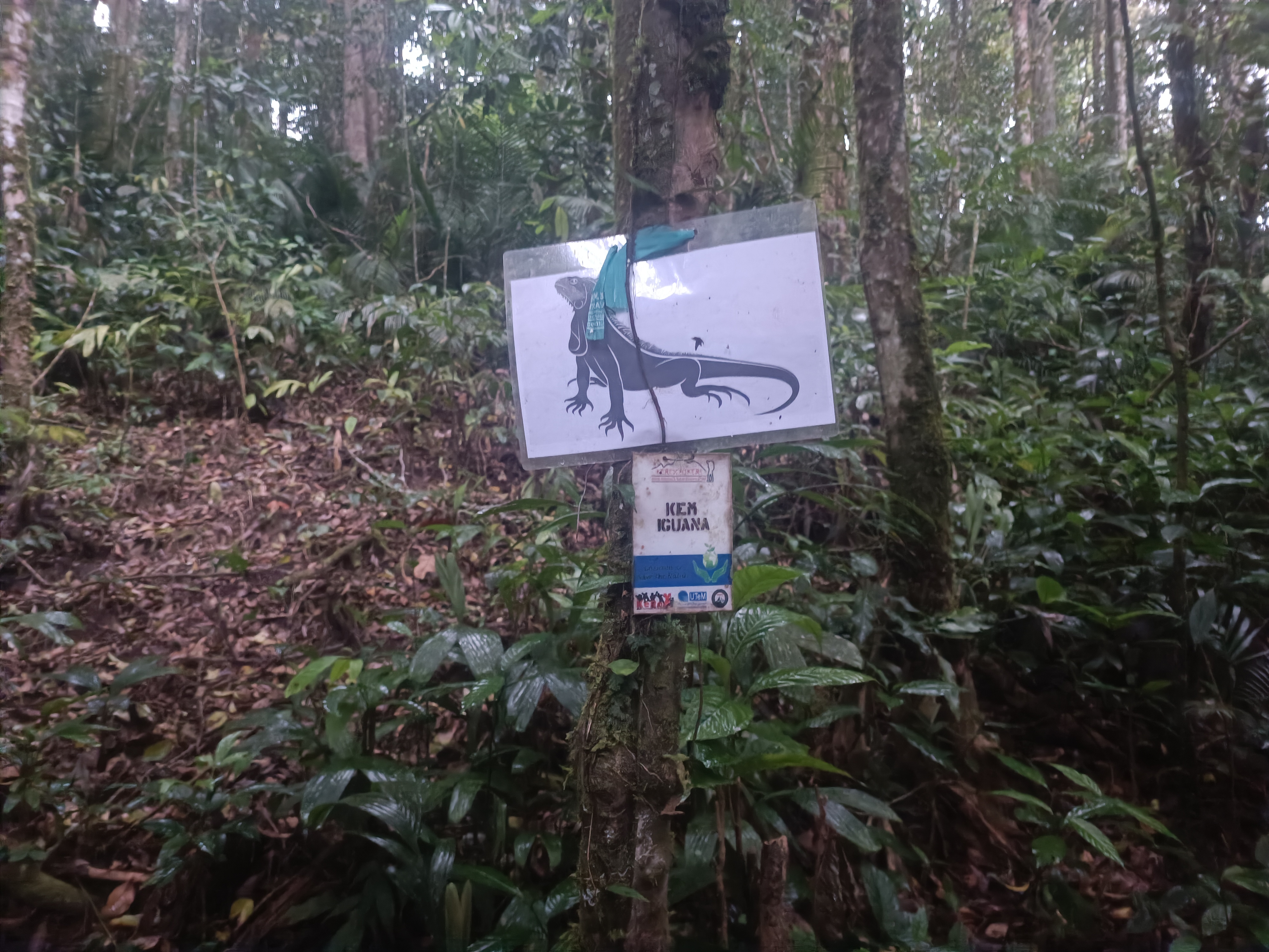
Camp Iguna (waterpoint and proper campsite) (20.0km)
Puncak 1420 (23.5km)
Camp Batu Tenggek (proper campsite)
Camp Batu Teduh
Liang (26.2km)
The trail is messy around here so "Parang" is a must as the trail rarely get visitor no thanks to all the "requirement" and unreliable "requirement" which can't even bring you to Semangkok in a day. The first stop would be Gua Batu (forgot the distance)
Do note the route around Gua Batu is a bit messy, I did mistook some route and thought I have to climb down into the cave which wasn't the case. If the route look suicidal, then it is not the route. Though, this place is beautiful.
 |
| Gua Batu |
 |
| Gua Batu |
After a while, there is a camp site known as Camp Tadah but it just a small opening area with no nearby water source around. It just another place for you to rest. And as always, trail around here is dam messy.
After 17km of chopping (or 5km from Semangkok peak), you will reach Bukit Ulu Bernam. It is a small puncak here. Although, did lost the picture for this peak... As you move on, there is a few junction to take note after this.
 |
| (1 & 2 does go to 3-Boundary rock, 3 should go down to Tanjung Malim) |
Right after the peak, we actually took route number 3 since there was marking on the tree. Luckily I unconsciously just look at my GPX watch and notice we were off target. Hence the u-turn, but since I don't really follow GPX at time, we were just following the state border line (which also had it own marking) until we hit a dead-end (huge fallen tree).
At this point, I think all of us were kinda doubting since we weren't on the GPX line. (which was also a bad idea soon) We U-turn again and make our way back to the GPX line and follow it.
.jpeg) |
| The pink trail is our route, we were following the red trail during that time (Do note that the pink "wrong" route had some marking with them while the red don't) |
Yeah, the red trail we follow had a few small sign of trail but it was nevertheless same thing as the previous trail, huge fallen tree making a dead-end for us... But this was already half-way down so... Den from SOS being Den, he took lead and start chopping a new trail with Elsa navigating all the way down to Camp Ulu Bernam. (It took us 1hour to chop open up a 800m trail from scratch...)

The map above say it all I guess, but if you were to take the "proper" boundary road, you have to take a right turn at a junction to find the waterfall of Ulu Bernum. Straight ahead you will find Camp Ulu Bernum nearby though just like Camp Tadah, it a small opening area. If you want to do camping, you might as well go toward Camp Iguana which is a proper campsite.
 |
| Ulu Bernum Waterfall |
 |
| Camp Ulu Bernum (which is after the Junction) |
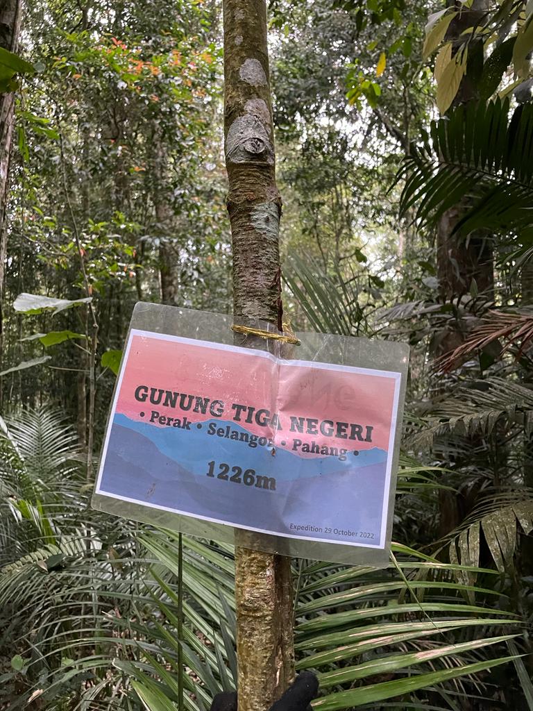
Not far away from Camp Ulu Bernam, you will reach Gunung Tiga Negeri, there was no boundary state rock here though, most also we saw is a single rebar sticking out only.

 |
| Camp Iguana |
After Camp Iguana, it will be an uphill from here onward and we started our night hike from here onward at 7:30pm. (Well, it was kinda of a dragonback coming from Semangkok but it was still mainly downhill). The uphill was quite straight-forward even in the dark but it gotten quite a mess at 22.5km mark or the top of the mountain ridge. We were in the end chopping a new route out at this point, moving at 300m/30min...
.jpeg) |
| It was the end of the climb and on top of the ridge, so even though in the dark with a mess-up trail it was easy to navigate as all you have to do is not walk any downhill. |
After the 300m, the trail was clear all the way until the top of Liang. But before that, Puncak 1410 was the place we stop and eat a bit more before the final push to Liang peak and back down plus me and Elsa had prior trail recce the year before from Liang peak to Puncak 1410 so we were confident with the route after here. (We also did say we were not going to eat at the Liang peak but rush down the mountain after that.) So the below is our short summary between Puncak 1410 to Liang Peak.

 |
| Puncak 1410 (during daytime, year before recce) |
In between Puncak 1410 and Camp Batu Teduh has a campsite, Camp Batu Tenggek with plenty of space to camp on but there is no water source around here.
 |
| Camp Batu Tenggek (year before recce) |
 |
| Camp Batu Teduh |
 |
| Camp Batu Teduh during day (year before recce) |
The trail all the way was clear for experience forest hiker. Normally once you reach a very very steep climb where you have to lift your head, you are basically at the final leg of the climb toward Liang
 |
| Gunung Liang East (28.0km) (Everyone can still joke and wanted to take on Trans-Slim...) |
 |
| Liang view |
 |
| Liang star star |
After that, all Liang detail can refer here:
Our rough timing
05.40am - Start
07.20am - Pine Tree
07.50am - Twin Peak
09.20am - Camp Merah
12.00pm - Semangkok
16.05pm - Bukit Ulu Bernam
18.35pm - Camp Iguana
21.05pm - Puncak 1420
00.00am - Liang West
04:04am - Carpark
Edited:
19/9/2023