Gunung Chabang

Distance: 12km 
EG: 1,400m
Rated: 6.0/10


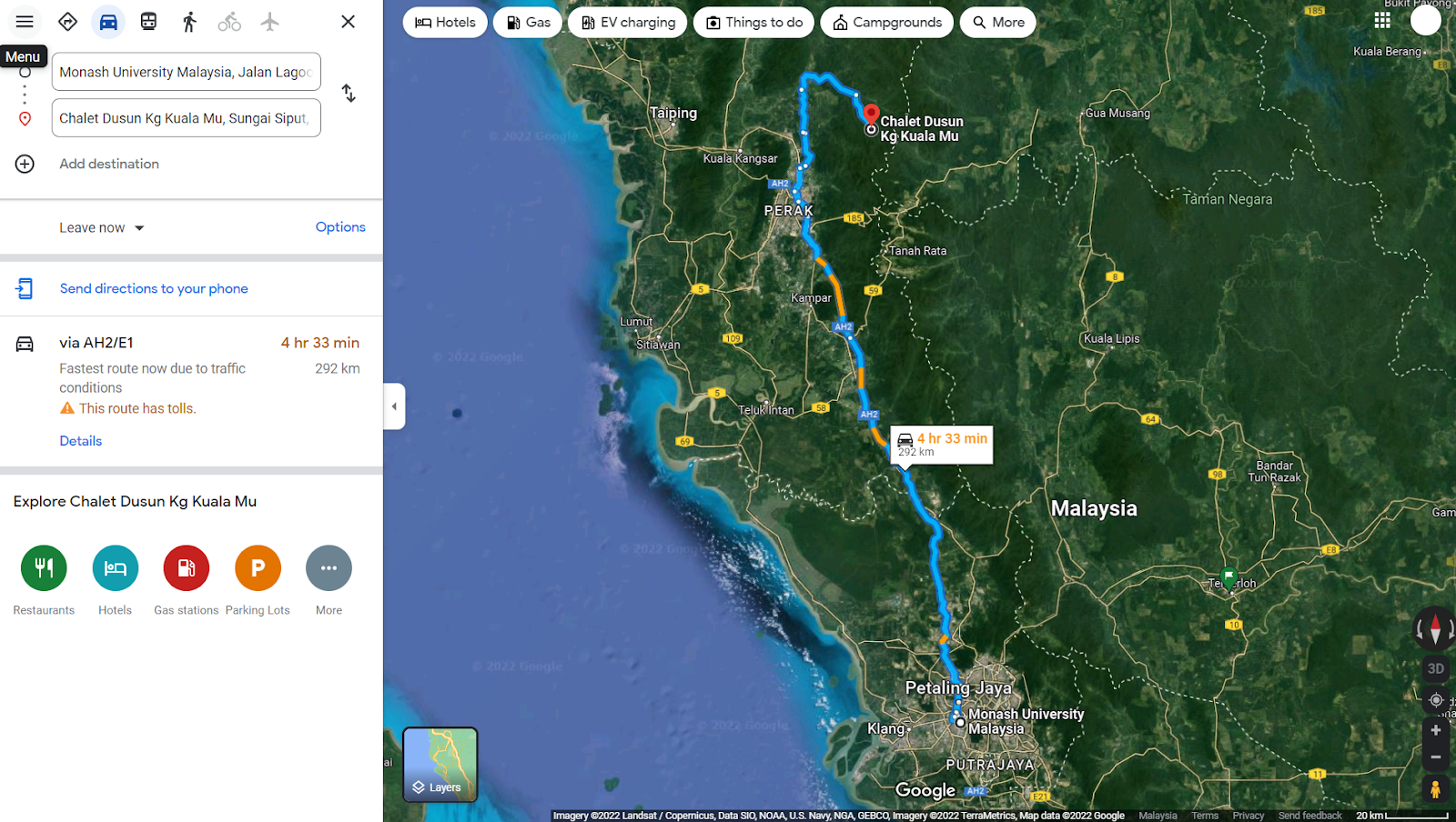
Gunung Chabang, a mountain good for training elevation gain. You will pass through "Pos Slim" to get into the entrance. 

To get here, first you need to GPS to this location "4.570660, 101.279073". It do be parking your car on the side of the road, unless you plan to camp, there is a space to park your car, but no matter what, you are not allowed to enter their kampung to park your car.


Toward Chabang Trailhead

Where to park.

Where to park


They do charge RM10-30 for car park (depending on day). There is no public facilities here. Forest permit is required though. 

https://www.strava.com/activities/7964884928
GPX File:  https://www.dropbox.com/s/xw11x7lu3u2ddvp/Mount_Chabang_.gpx?dl=0


The start of the trail is hard to find. moreover, right after the start of the trail, there a few confusing junction. 


Start of trailhead after 400m on the road


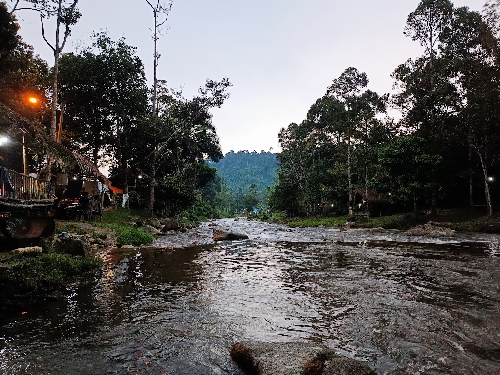
If you see a downhill toward a river, you are on the right path
(Note: I had a friend who couldn't cross this river after a rain, it look small but can be a huge nope during rain)


The following junction shown is from 15th October 2022, unsure if it will change in the future:

First junction, take right


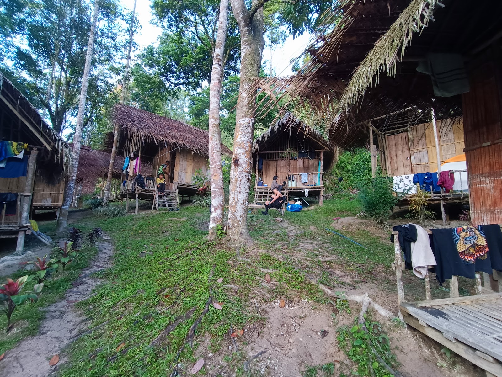
Which you will see a house, take left here


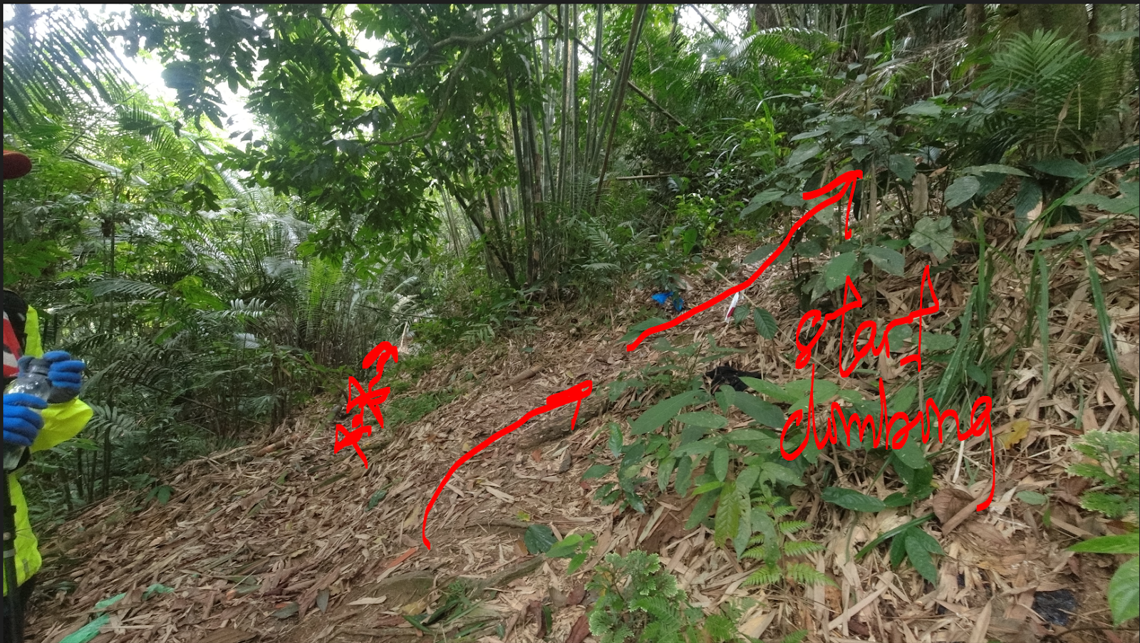
Last major junction, turn right and start climbing


After that, there are mini junction, but it should be obvious at this point


River crossing

After that, it just a climb up to the peak of the mountain. There isn't much to offer here, just you, and tree and a lots of trees.


This is a mini campsite which I forgot which distance, though water source I can't confirm


There is another junction here around 4.5km-5.0km. To take right here.


Checkpoint to take note:
-All the junction at the start of the trail.
~6km - Peak / Summit

There isn't much to say about this trip as the whole trip is just hiking up the mountain, at least there mossy forest to see. Though it is also a good elevation training. 

Last edited
18th October 2022


Gunung Yong Yap via Gepeh

Distance: 19km 
EG: 1,800m
Rated: 6.5/10 

Gunung Yong Yap, it is the sixth tallest mountain in Peninsular Malaysia or also known as G6. Though, this trail is rarely used but it has been cleared since my last visit. The starting point of the trail head is at Kuala Mu, Sungai Siput. 

To get here, first you need to GPS to this location (this is our accommodation point though): "4.835847, 101.334941" or Chalet Dusun Kg Kuala Mu. Do note this isn't the starting point of the trailhead, we took a 4WD into the forest. (Also to note, we didn't take the original starting trailhead, there is a shortcut for this trail.)


Our 4WD route (It is runnable if you to save money on 4WD)
GPX: (https://www.dropbox.com/s/lpr5z6u5r1i5a9n/Yong%20Yap%20Gepeh%204wd_ride.gpx?dl=0)

Since this point is our accommodation area, all public facilities is available but the trailhead has nothing. Side note: this trail is well known to have a lot of wild and not-so-friendly animal, to take pre-cautions during  hike. 


https://www.strava.com/activities/7634628310
GPX File: https://www.dropbox.com/s/bhnjvbxtt2ttwze/Yong_Yap_via_Gepeh.gpx?dl=0

This trail is only 19km which is less than the Pos Rengil trail by two times. It definitely make Yong Yap so much easier to conquer.  The trailhead isn't obvious though, would be best if you bring someone who is familiar with the trail first. But once you find the trail, it straightforward all the way without much junction. The only junction to take note especially when returning is between starting point and Camp Sungai Chinak as this junction will bring you to the original starting point of the trail (around 3km).

After 5km, you will reach Camp Sungai Chinak, although there is a "water point" on top, it best to refill here for the trip as that "water point" have to walk a distance for it. There are hiker who camp here to and is a big area. 


Camp Sungai Chinek (this video is the returning trip though)


Camp Sungai Chinek


After this campsite, it a straight climb to the peak.


Checkpoint to take note:
Starting Point
~3km - Junction
~5km - Camp Sungai Chinek (refill here)
~7-8km - Last Water Point (didn't bother checking where the water point though)
~9.5km - Summit.

The return trip do be fun though as you will climb a good 200m+ before reaching the end of the trail.

There isn't much to say about this trip as the whole trip is just hiking up the mountain, at least there mossy forest to see. If you want to stamp your G7 trip, this trail is really a shortcut to it. But as last mention, please take note of wild animal here.

PS. 4WD that day: +60 12-451 5550, Den under S.O.S.

Last edited:
13th August 2022