The Hiking Trails I Have Suffered Through!!

A plain and ordinary guy who love hiking up mountain and hill, enjoy the breathtaking view of the mountain and the air above all high rise building. I have hike quite a few of mountain and hill in Malaysia and enjoyed all of them, but to me it never enough as world has a lot to offers. I do hope this blog will serve as a guide to the new hiker or some who are new to certain mountain. Below are the list of hiking treks I have done and how I would rate (Disclaimer: it not an accurate rating system, take it with a pinch of salt)

Hiking Activity Without Camping:
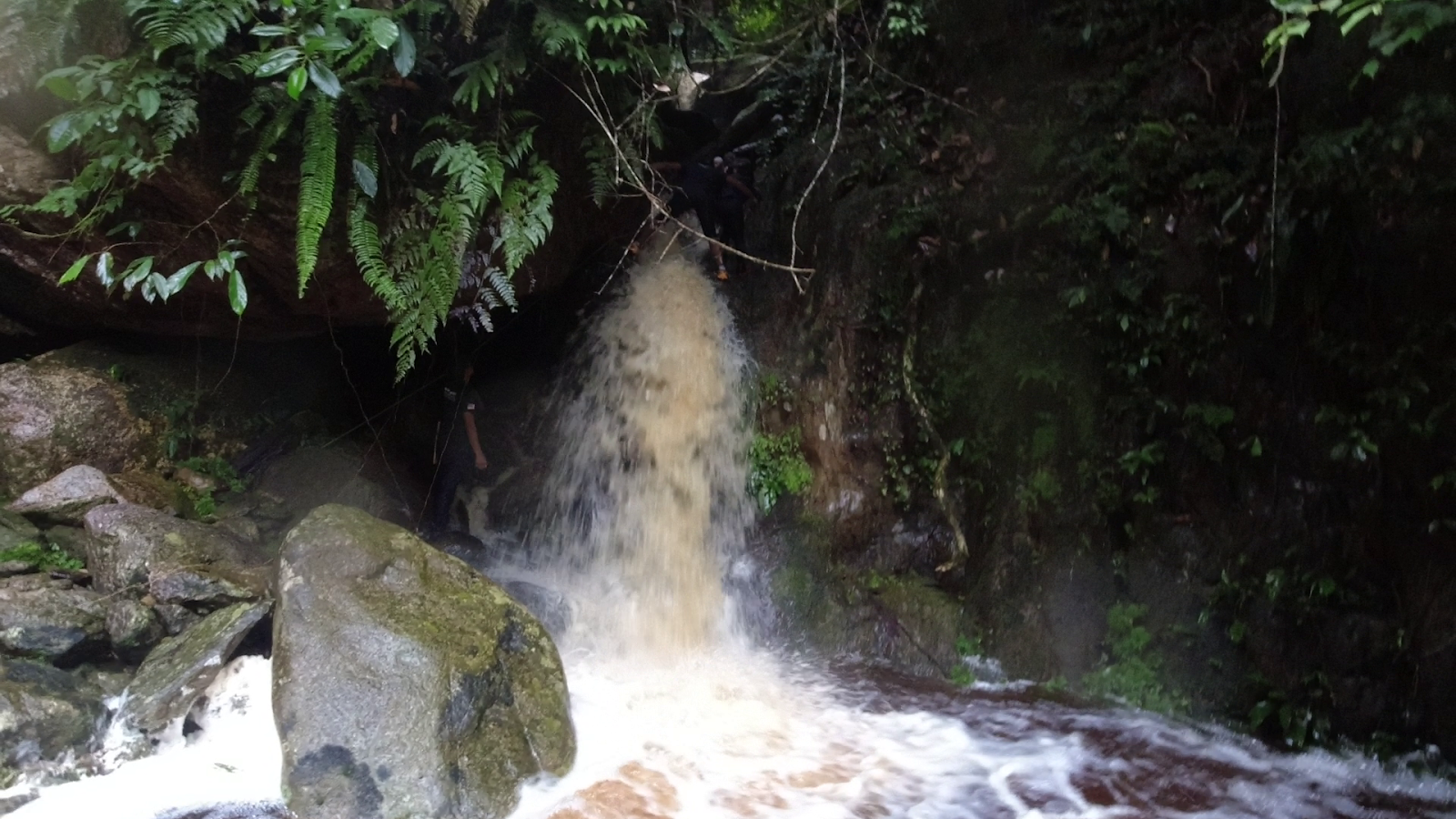
1.0/10  Chilling Waterfall via main entrance [half day] 
1.0/10  Tanjung Tuan Forest Reserve (Across the island via Main Entrance) [half day]
1.5/10  Puchong Hill via Jalan Wawasan [half day]
1.5/10  Bukit Panorama via main entrance [half day]
1.5/10  Broga Hill via main entrance [half day]
1.5/10  Gasing Hill via main entrance (it depends on the route though) [half day]
2.0/10  Kota Damansara Community Forest (it depends on the route though) [half day]
2.0/10  Apek Hill via Jalan Awana (to waterfall) [half day]
2.0/10  Tanjung Tuan Forest Reserve (Around the island via Cermin Pantai) [half day]
2.0/10  Bukit Kiara (it depends on the route though) [half day]
2.0/10  Bukit Bangkong, Perak [half day]
2.0/10  Bukit Liman Kati, Perak [half day]
2.5/10  Gunung Hijau, Peak [half day]
2.5/10  Saga Hill via Jalan Saga (to waterfall) [half day]
2.5/10  Tabur Hill via west entrance [half day]
2.5/10  Tabur Hill via east entrance [half day]
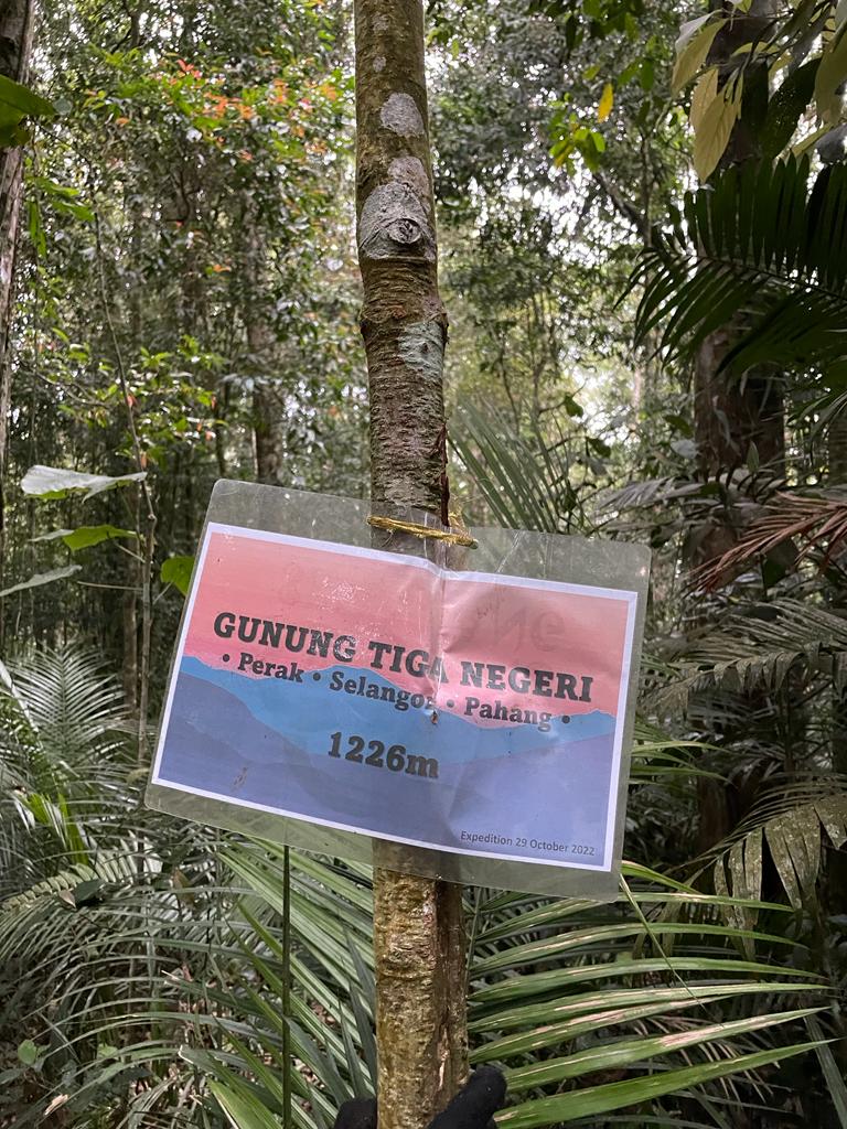
3.0/10  Gunung Telapak Buruk [half day]
3.0/10  Tabur Hill via extreme entrance (Kemensah entrance) [half day]
3.5/10  Kledang Hill, Perak [half day]
4.0/10  Gunung Datuk via main entrance [half day]
4.0/10  Bukit Raka [half day]
4.5/10  Bukit Chenuang [3/4 day]
5.0/10  Ampang Lookout Point (via Jalan Awana). [3/4 day]
5.0/10  Gunung Hitam [3/4 day]
5.0/10  Bukit Kutu via Kampung Pertak [3/4 day]
5.0/10  Gunung Suku via A181, 31300 Ipoh, Perak [3/4 day]
5.0/10  Pine Tree Peak / Twin Hill Peak via Fraser Hill [3/4 days]
5.5/10  Gunung Datuk, Rembau and Gagak [3/4 day]
5.5/10  Gunung Irau via Mossy Forest [3/4 day]
5.5/10  Gunung Nuang via Janda Baik [3/4 day]
6.0/10  Gunung Berembun and Telapak Buruk [1 day]
6.0/10  Trans-Langat/Genting Peres [1 day]
6.0/10  Trans-Bukit Chenuang + Batu Kumbang [1 day]
6.0/10  Gunung Hantu Besar [1 day] // 6.5/10 Add-on Lata Kijang [1 day]
6.0/10  Gunung Chabang [1 day]
6.0/10  Gunung Nuang via Hulu Langat [1 day]
6.5/10  Trans-Kledang (From Kledang Hill to Manong Hill) [1 day]
6.5/10  Gunung Yong Yap via Gepeh [1 day]
6.5/10  Gunung Yong Belar via Camp Cabin/Kebun [1 FULL days]
6.5/10  Gunung Rajah via Chamang Waterfall, Bentong  [1 FULL days]
6.5/10  Gunung Rajah via KKB  [1 FULL days]
6.5/10  Gunung Liang [1 FULL days]
6.5/10  Trans-Jerging (Suku > Irau > Yellow > Pass) [1 FULL days]
6.5/10  Trans-Naning (Start Datuk > Including Tarmac Road) [1 FULL days]
7.0/10  Gunung Repin via Kemensah [1 FULL days]
7.0/10  Trans - Gunung Yong Belar - 3 Boundary [1 FULL days]
7.0/10  Gunung Korbu via Ulu Kinta SAS Dam [1 FULL days]
7.0/10  Gunung Semangkok via Twin Peak Hill [1 FULL days]
7.0/10  Gunung Batu Putih via Kuala Woh [1 FULL days]
7.0/10  Gunung Ulu Sepat via Pos Lelar [1 FULL days]
7.0/10  Trans-Reverse-Gunung Nuang [1 FULL days]
7.5/10  Gunung Gayong via Gunung Korbu [1 FULL days]
7.5/10  Gunung Yong Yap via Kampung Renggil [1 FULL days]
7.5/10  Gunung Tumang Batak via Gunung Liang [1 FULL days]
7.5/10  Gunung Benum via Sg. Klau [1 FULL days]
7.5/10  Gunung Chamah via Pos Rekom [1 FULL days]
7.5/10  Trans-Bubu / Trans-Kuala Sepetang [1 FULL days]
7.5/10  Trans-Batu (via Batu Putih) [1 FULL days]
8.0/10  YYBBTN (Yong Yap-Bubu-Tok Nenek) [1 FULL days]
8.0/10  Trans-Titiwangsa V1 (via Camp Kebun/Cabin) [1 OVER days]
8.5/10  Gunung RaTu [Rajah-Kutu] (via KKB) [1 OVER days]
8.5/10  Trans-Titiwangsa V1 (via Ulu Kinta SAS Dam) [1 OVER days]
8.5/10  RaTu Medang [Rajah-LataMedang-Kutu] (via KKB) [1 OVER days]
Hike with Camping Activity:
5.0/10  Gunung Rajah via Chamang Waterfall [2 days]
5.0/10  Chemerung Berembun Langsir (CBL) [3 days]
5.0/10  Gunung Baha, Ayam, Stong [3 days]
5.0/10  Gunung Kinabalu via Timphon with Ferrata [2 days]
5.5/10  Gunung Kerinci via Kersik Tuo [2 days]
6.5/10  Gunung Tahan via Merapoh [3 days]
7.5/10  Gunung GBB via Pos Lelar [4 days]
7.5/10  Gunung Rinjani via Sembalun to Senaru [4 days]
P.S. [half day] = less than 5 hours of hiking
       [3/4 day] = less than 8 hours of hiking
       [1 day]    = more than 8 hours of hiking
       [1 FULL days]   = more than 12 hours of hiking
       [1 OVER days]  = more than 24 hours of hiking
P.P.S: Hiking rating it just loosely based on how I felt during the hike.
P.P.P.S: Climb a mountain not to plan your flag on top but to enjoy the challenge, the achievement and the view the mountain has to offer.

Other Activities:

2017:
TITI Ultra, 2017, 100km (DNF at 48km)
The Magnificent Merapoh Trail 2017, 70km
Batu Arang Ultimate Direction The Signature Cross Country 2017, 83km
2018:
Mount Tahan Climbathon 2018, 65km Official / 35km GPS (DNF due to COT)
Translantau 2018, 100km
Cameron Ultra 2018, 100km
The Most Beautiful Things, TMBT 2018. 100km
Janda Baik Ultra, 2018, 100km
Malaysia Mountain Trail Festival, MMTF, 2018, 70km
2019:
TITI Ultra, 2019, 100km
Penang Eco 100miles (DNF at 127km)
Cameron Ultra, 100km (DNF at 60km)
Malaysia Backyard Ultra (DNF at 56km)
Klau Jungle Ultra Marathon, 60km
The Magnificient Merapoh Trail, 100km
Ultimate Trail of Penang, 100km
The Great Malaya Trail, 100km
Malaysia Mountain Trail Festival, MMTF, 84km
2020:
Kiara Ultra Challenge, 50km

To note: I too lazy to update all the running event I going after this.

Semaliang via Semangkok


Distance: 38km 
EG: 2,900m (3,900m if coming from Liang)
Rated: 9.0/10

Semaliang, one of those infamous trail where you do cause you love suffering. There really isn't a reason for one to do this trail except to just tell your friend, I did it. There no magnificent view, the 3 boundary rock has corroded to non-existent, the trail is not a highway like Trans-Titiwangsa V1, V2 or CUS and so many thorns... The only thing that was a nice was the rock formation both going down 3 Boundary and going up Liang.

We start from Pine Tree / Semangkok which detail can be refer here:

https://www.strava.com/activities/8815526676
GPX File: https://www.dropbox.com/s/li3n3z0eb4eolpz/Semaliang_.gpx?dl=0

The journey after Semangkok peak is a wild and raw trail. If one is not experience in looking for trail or differentiating trail and not-a-trail, one can easily lose their way. 

The following are the checkpoint (Distance based on my GPX file:
Semangkok (12.5km)
Gua Batu 
Camp Tadah
Bukit Ulu Bernam (17km)
Camp Ulu Bernam (waterpoint at Junction) (18.7km junction - 19km campsite)
Gunung 3 Negeri 
Camp Iguna (waterpoint and proper campsite) (20.0km)
Puncak 1420 (23.5km)
Camp Batu Tenggek (proper campsite)
Camp Batu Teduh
Liang (26.2km)

The trail is messy around here so "Parang" is a must as the trail rarely get visitor no thanks to all the "requirement" and unreliable "requirement" which can't even bring you to Semangkok in a day. The first stop would be Gua Batu (forgot the distance)

Do note the route around Gua Batu is a bit messy, I did mistook some route and thought I have to climb down into the cave which wasn't the case. If the route look suicidal, then it is not the route. Though, this place is beautiful.

Gua Batu


Gua Batu 

After a while, there is a camp site known as Camp Tadah but it just a small opening area with no nearby water source around. It just another place for you to rest. And as always, trail around here is dam messy.

After 17km of chopping (or 5km from Semangkok peak), you will reach Bukit Ulu Bernam. It is a small puncak here. Although, did lost the picture for this peak... As you move on, there is a few junction to take note after this.

(1 & 2 does go to 3-Boundary rock, 3 should go down to Tanjung Malim)

Right after the peak, we actually took route number 3 since there was marking on the tree. Luckily I unconsciously just look at my GPX watch and notice we were off target. Hence the u-turn, but since I don't really follow GPX at time, we were just following the state border line (which also had it own marking) until we hit a dead-end (huge fallen tree). 

At this point, I think all of us were kinda doubting since we weren't on the GPX line. (which was also a bad idea soon) We U-turn again and make our way back to the GPX line and follow it. 

The pink trail is our route, we were following the red trail during that time
(Do note that the pink "wrong" route had some marking with them while the red don't)

Yeah, the red trail we follow had a few small sign of trail but it was nevertheless same thing as the previous trail, huge fallen tree making a dead-end for us... But this was already half-way down so... Den from SOS being Den, he took lead and start chopping a new trail with Elsa navigating all the way down to Camp Ulu Bernam. (It took us 1hour to chop open up a 800m trail from scratch...) 


The map above say it all I guess, but if you were to take the "proper" boundary road, you have to take a right turn at a junction to find the waterfall of Ulu Bernum. Straight ahead you will find Camp Ulu Bernum nearby though just like Camp Tadah, it a small opening area. If you want to do camping, you might as well go toward Camp Iguana which is a proper campsite.

Ulu Bernum Waterfall

Camp Ulu Bernum (which is after the Junction)

Not far away from Camp Ulu Bernam, you will reach Gunung Tiga Negeri, there was no boundary state rock here though, most also we saw is a single rebar sticking out only.

After a short while, we reach Camp Iguana. The campsite here is huge and surprisedly quite well maintained (well, during our visit). Plenty of space to camp here and there a river source right beside the campsite.


Camp Iguana

After Camp Iguana, it will be an uphill from here onward and we started our night hike from here onward at 7:30pm. (Well, it was kinda of a dragonback coming from Semangkok but it was still mainly downhill). The uphill was quite straight-forward even in the dark but it gotten quite a mess at 22.5km mark or the top of the mountain ridge. We were in the end chopping a new route out at this point, moving at 300m/30min...

It was the end of the climb and on top of the ridge, so even though in the dark with a mess-up trail
it was easy to navigate as all you have to do is not walk any downhill.

After the 300m, the trail was clear all the way until the top of Liang. But before that, Puncak 1410 was the place we stop and eat a bit more before the final push to Liang peak and back down plus me and Elsa had prior trail recce the year before from Liang peak to Puncak 1410 so we were confident with the route after here. (We also did say we were not going to eat at the Liang peak but rush down the mountain after that.) So the below is our short summary between Puncak 1410 to Liang Peak. 

Puncak 1410 (23.5km)

Puncak 1410 (during daytime, year before recce)

In between Puncak 1410 and Camp Batu Teduh has a campsite, Camp Batu Tenggek with plenty of space to camp on but there is no water source around here.

Camp Batu Tenggek (year before recce)


Camp Batu Teduh


Camp Batu Teduh during day (year before recce)

The trail all the way was clear for experience forest hiker. Normally once you reach a very very steep climb where you have to lift your head, you are basically at the final leg of the climb toward Liang
Gunung Liang East (28.0km)
(Everyone can still joke and wanted to take on Trans-Slim...) 


Liang view


Liang star star


After that, all Liang detail can refer here:

Our rough timing
05.40am - Start

07.20am - Pine Tree 
07.50am - Twin Peak
09.20am - Camp Merah
12.00pm - Semangkok
16.05pm - Bukit Ulu Bernam
18.35pm - Camp Iguana
21.05pm - Puncak 1420
00.00am - Liang West
04:04am - Carpark

Edited:
19/9/2023


4 Step Waterfall (Via Trans-Tahan -- Merapoh to Kuala Tahan)

Distance: 105km 
EG: 5,250m
Rated: 10/10

(9 Days Camping Trip, 29th October 2022 - 6th November 2022)

*This blog only include 4 Step Waterfall trip cause there way too many Trans-Tahan blog out there anyway :P


More info on Tahan (Merapoh only) here: 


Prologue:
The initial plan was to do 8 days but the team have to be very consistent and must have the pace even with the heavy bag. Our initial plan as follow:
Day 1: Kubang Camp
Day 2: Gedung Camp
Day 3: Teku Camp
Day 4: Pasir Mengkuang Camp
Day 5: Dayhike
Day 6: Teku Camp
Day 7: Camp Tengah / Melantai
Day 8: Out

To move faster, I also opt to stay in a fly-ground sheet instead of tent which lessen bag weight by a lot. Cold? I did invest in a better sleeping bag and jacket. My starting weight 50L bag + 1.0L waist bag with food ration was 21kg. 

Our Fly-Ground Set-up (Major thanks to Jack Wong for setting it up everyday)

We did hire a porter for 15kg to carry most of our food ration. Porter Amy and Guide Abang Long was with us for the trip.

Before entering the forest, we were told that there was only 3 attempts to the four-step waterfall this year, one trip failed due to being lost and rain, second one the group said they make-it but there was no proof of photo or anything like that. Our group would be the last attempt for the year. (Even being the last group of hiker to enter Tahan for the year)

Thing I brought (~11-13kg) < [Last day of the hike with wet bag and only 3 Hutan Ration left, it was at 13kg]
- Power Bank 10,000mAh for GoPro, Watch + Phone for music (not enough though)
- 4 Set of shirt (1 for hiking[with rain-jacket], 1 for sleeping[with jacket], 1 for after Tahan trip, 1 for emergency) ++ extra sock & slipper
- Personal food ration (mostly hutan ration only + 2 Kembara + Wrap + Salt Candy + Vitamin C + Peanuts + Milo + 2 Maggi)
- Sleeping bag + Mat + Inflatable pillow (I don't trust inflatable mat)
- Gas + Mess Tin + Utensil + Stove
- 4 nos. 500ml flask and bottle + 5L water storage
- Chair and Table
- Mosquito burning coil
- Soap + Toothbrush and etc.
- "Wipe leg+groundsheet" towel and body towel

Others: (~7-8kg)
- Food ration for dinner (by Jack and Sammy) and lunch (by Rex Kee)
Egg and Cooking Oil? We shall not talk about that here, what happen in Tahan, stay in Tahan.

Thing I should have brought:
- Umbrella

Breakfast were typically wrap bread and two morning of Maggi 
Lunch was either 
-chicken rice with baked potato + fried rice seasoning + lady finger
-rice + sardine can 
-2 days of Kembara

In-between is typically hutan ration, snicker and salt candy.

Few days before:
As I just came down from Trans-Batu that week Monday, I was busy cleaning most of the equipment and only really start packing on Wednesday. Thank you Rex Kee and Jack Wong for settling all the food issue as I only needed to think of what essential item to bring only. 

The menu you said? Yeah, I forgot. All I know everyday dinner was extremely nice (prepared by Sammy and Jack) while lunch was extremely nice prepared by Rex Kee. 

(Merapoh - Tahan Peak - Teku Camp) <-- Story that I will write one day I guess...

Day 4:
During our trip, there was a little bit of weather issue, day 4 is the day we were supposed to be at Teku Camp and start our journey into the 4-Step Waterfall trail, but we were stuck at Pangkin Camp unfortunately.

Today since we were coming down from  Pangkin Camp, we arrived Teku Camp at 11:30pm. As we were behind schedule for the 8 days schedule, we wanted to continue into 4-Step Waterfall trail since we had a lot of time... 

But the weather had other plan for us today. It had been raining continuously since last night, the rain then continue again around 12:00pm. Knowing that the 4-Step Waterfall trail is full of river crossing, our guide needed us to stand down for the fear of river flooding. And rightfully so, later that evening around 6:30pm, the river level rises quite high. (Side note: since we didn't know how far deep the waterfall is, we wanted to just daypack from Teku, to and back, as quick as possible. Mana tau, we were extremely wrong with the distance and time required...)

Day 5:
Day 5 was the day, detour from your typical trail of Trans-Tahan, Previously, we were all hiking at our own pace, some of our friend were hiking faster than both our guide and porter, but since the trail we entering is consider even wilder compare to the normal trail, we were going to have to stick together ad encountering wild animal inside this trail is much higher.

Since daypack is out of the option, we left some of our stuff back here in Teku Campsite to have a lighter  bag pack, brought in 3 days worth of foods. Started our journey around 8:00am, and not even that far into the trail, the trail has become quite raw to hike in. 

Generally the whole trail is what you truly call a wild jungle trail and make Trans-Titiwangsa V2 trail condition look like a highway. Our guide were very busy chopping tree in front with Jack, while we having the smaller knife clean the trail. 

Very unclear trail, marking little to none


A lot of chopping


It wasn't just thick jungle and bushes though, we even have to deal with multiple deep river crossing.


But there are some part where it was really interesting, walking on rock beach and sand beach. Once you reach this long sand beach, this is where Pasir Panjang Campsite is situated or so they say.

Rock Beach

Sand Beach (Pasir Panjang Campsite)

But since we have plenty of time, we push on deeper into Pasir Mengkuang Campsite. And to show just how raw the trail is, the whole journey is only 12km with almost no elevation gain, typically we can do it under 4 hours no problem, but this journey alone took us 7hours30mins (does include I think almost 1 hour rest but still...)
We reached our campsite at 3:30pm and decided to stay here. Yeah, there isn't a lot of space here though.


It does look scarily near the river but one way to look at it is the leaf marking, always try to set your campsite higher than this marking.

Indication for river flooding (btw, this picture is not Pasir Mengkuang Campsite)

Since it was early here, we had time to play river and really just relax on the side.


7:00pm, the rain suddenly started and it wasn't light. We did put some of our stuff out near the river but regardless, we collected everything and put it as far away from the river. Because river flooding is really no joke. It was also by this time that we just finished eating our dinner so we went to bed early. Not until the rain started splashing into the fly-ground, since earlier we didn't have enough time to install the extension flysheet, I had to open my emergency blanket just to cover the splashes. 

Around 9pm, the river started roaring loudly, but knowing we were above the line, most of us weren't bother by it except for Rex. Since the space here were very limited, his tent was just below the line, but luckily the river rises nowhere near his tent.

Yeah, didn't really slept well tonight due to constant splashing. 

Day 6:
The next morning, as expected, the river swelled from the rain but regardless... Breakfast was just wrap bread.

This is the day we shoot for the waterfall and started at 10am. As usual, the whole trail was as raw as always but with only 2 deep river crossing. Since it rained last night, the river had swelled up and crossing it was difficult. Luckily Elsa brought her rope for us to use. (MGP Perak don't play play aa)


After a while, a few mini dragon-back climb, then came the waterfall trail. It was also at this time, it started raining again, this is around mid-day and the rain is the type that will fall for a long time. 

I was worry about the whole trip being cancelled due the river swelling but the guide was very experience knowing that since we were actually very high-up of the river-end, the swell wouldn't be as bad, so we moved on.

Before rain (We have to climb up this)

Before rain

Waterfall trail


After the waterfall trail, due to the raw trail plus our guide hasn't actually been here since 2016. We ter-took the wrong turning after this part of the trail and went off-course.


I thought we almost couldn't find the waterfall plus since the trail is not a trail, the whole ground was either very leafy or the ground was very loose. Do note It was already 3pm (5 hours since the start) and we haven't found the fall yet at this time. 

But with the exceptionally powerful navigation skill from the guide, we cut through the trail and we found the fall. It wasn't 4-Step Waterfall though at this time, more like a single-step waterfall as you were supposed to see the 4 Step Section of the Waterfall. 

Even so, it was still very beautiful and frightening at the same time. Typically you could go onto the rock to take more photo, but with such a strong force of water even being felt from a distance, no one here is dumb enough to go for it. 

Just witnessing it from a distance was already very magical.


As much as we would like to stay here, it was very cold here with the wind from the fall and the cold water splashes. So we headed down, this time toward the proper trail. The trail was so proper this time, most of us were "speeding" down. IT WAS VERY STEEP and SLIPPERY. We had one person who fall and accidentally koyak her finger, but thank God it wasn't a "big" issue as she crack back her finger... (it still big but not to the kind where we had to call for help).

After that we reached the waterfall trail and guess what, water swell. At one point, our guide even have to find a long tree trunk to makeshift as a bridge for us to cross. 

After rain

After rain (we had to climb/abseil down this)


After the waterfall trail, it was backed to the normal trail. At this time was already almost 6pm, with still quite a distance left to our campsite, we prepare for the night. As the trail was more open this time, we had a better moving time back to our campsite. During the whole trip, since I was kinda saving on food, I was only eating Hutan Ration and Salt Candy the whole day.

At 8pm, after 14km with ~1000m E.G., we had to cross back the two river crossing. They did swell more compare to the morning, but luckily our guide and porter and Jack was very experience with strong water current, all of us make it back to the campsite by 8:30pm and prepared for bed.


Oh yeah, since our fly-ground was quite small and since last night I really couldn't sleep well. With Andreas kindness, he "rent-ed" his tent space to me for the night. Also, since most of our bag were starting to stink, we finally decided to leave it outside. Wet? It was already wet from all the deep river crossing...

Day 7:
We packed, ate our breakfast and left at 9.40am for Teku Campsite. The way back wasn't much difference except for a few detour where we didn't exactly took the same road back. Just to show you how raw and confusing this trail can be.

Due to the rain yesterday, the river crossing was deeper compare than the day 5 river crossing. 


Even I mistook something in the river and got hook onto the tree trunk, gulping and blubbing teh tarik in the process. 

Of all thing, when we reached somewhere in the middle of the trail, the front group (though only like 30second in front) saw very fresh elephant footprint and poop, a few second later, they saw a wild elephant. While we at the back miss it and thought we wouldn't see it anymore. By for some reason, I would just hold onto my "GoPro" and was just recording along the way.

Mana tau, after a few second, he came out again. And it doesn't look scary on video or photo but the atmosphere on the spot was very difference. We were scared it run out, the porter was prepared to abandon his bag and our guide was also terrified and asking us to prepare to run.


Thanks God, he only came out to say "hi" and didn't chased us. Was actually very grateful it was just him and without any child. Thing could turn out a whole lot difference. Our guide even started to burn some burning incense (luckily Jack brought some) in hope for the smell to "shoo" away the elephant.

The similar incense that used to shoo the elephant.

After 7 hours of hiking back out the 12km trail, we reached back Teku Campsite, 4:30pm. One would thought that this would be the end of journey for the day, but nope, all due to the unfavorable weather condition. In half an hour, we pack everything we left here at Teku Campsite (Thank God everything was in-tact) and left for our targeted campsite.

To give some insight, to go from Teku Campsite to Puteh Campsite, one have to cross Sungai Tahan 7-8 times, this river even without the rain is already very challenging to cross. The reason why our 4-step waterfall was a bit more successful is because the Sg. Tahan there is a smaller version. The version after Teku Campsite was much bigger as it mixed with Sg. Teku (another big river).
The most worrying one was due to Teku River. If both river swelled, we would have 
been stuck at Teku Campsite for another day.

Since it was raining this afternoon as we were heading out from 4-Step Waterfall trail, the risk of river swelling was increasing by the hour. 

As long as we cross this one river after Teku Campsite, our guide will be dam relief as there won't be another river crossing after this even after the river swelled badly (As shown below why)

Our Campsite on Day 7 is the exact location where you would cross the river the second time.
This is also the reason why we didn't have any river crossing later on, we took the other trail to avoid
all the river crossing.

So after the last and final river crossing (which is typically first one for the Trans-Tahan on normal day), our guide was very relief. At 6:30pm we reached our spot to put up for the night. Luckily this campsite, aka, the Second-River-Crossing-Junction Campsite aka Amy Campsite was a bit more spacious, even more spacious than Pangkin Campsite (our 3rd day campsite) and Pasir Mengkuang Campsite.


Second-River-Crossing-Junction Campsite / Amy Campsite

The most lucky part was all of us finish cleaning and taking bath after 9
:00pm. The only one left was Andreas which he was lucky to be deeper inside the smaller river, as after that, the Tahan River really did swelled 
This was taken before the river swelled, the red hatched was all river water after the 9pm "air kepala"

And that was the trip for the 4-Step Waterfall Trail. After this, the only difference is we detour over to the legenda trail and completely avoid all the huge river crossing and manage to came out on Sunday (9th day).

Our final hiking day as follow:
Day 1: Kubang Camp
Day 2: Gedung Tahan Peak Camp
Day 3: Teku Pangkin Camp
Day 4: Pasir Mengkuang Teku Camp
Day 5: Dayhike Pasir Mengkuang Camp
Day 6: Teku Dayhike to Waterfall - Pasir Mengkuang Camp
Day 7: Camp Tengah / Melantai Second-River-Crossing-Junction Camp / Amy Camp
Day 8: Out Tengah Camp
Day 9: Out


Last edited:
10/11/2022