Distance: 36km+ (42km on some GPS)
Elevation Gain: 2500m - 2900m+ (GPS inaccuracies on a lot of watch)
Rated: 6.5/10 (Camping 3D2N)
Gunung Tahan, the tallest mountain in the Peninsula Malaysia. With a height of 2,187 m, it offer a spectacular mountain view of the Tahan mountain range. Nevertheless, this mountain is not easy to hike and there are cases where hiker after climbing Gunung Kinabalu thought they would be able to handle Gunung Tahan and that is usually not the case. In this case, we book our hiking trip through an agent which help us arrange the itinerary. "4°40'30.736"N 102°3'42.026"E" is the GPS coordination to the Wildlife Department Office. There are general public facilities well prepared here such as toilet and car park. Hiker would also need to register at the counter before hiking and usually will be bag checked thoroughly (E.g. They will count your initial number of plastic bag and again after the hike, any missing number, hiker will be fined..... badly).
 |
| Map to Wildlife Department Office, Sungai Relau, Merapoh |
 |
| Zoom in map |
 |
| G. Tahan Hiking Trail via Merapoh |
GPX File Link:
The entrance to the G.Tahan hiking path does not start at Sungai Relau itself. Instead, hiker have to ride a 4X4 jeep ride to Kuala Juram to start the hike. The hike itself took 3 days to complete where we camp at Camp Kor and Camp Kubang on the first and second night respectively, we reach the top of the mountain on the second day around 4 pm approximate. There are a few river crossing where the river level is around knee tall.
This is guided hike with guide guiding us through the forest since it is a requirement to hike the mountain. During the hike, there is no toilet for business purpose or hut to sleep, everything is natural. You drink from the river (boiled it would be good), sleep in tent and do "business" at a tree (avoid near hiking path and camping area). [The only reason I pointing this out is because the were a few people in the group thought this would be a leisure hike like Mt. Kinabalu with tap water and hut prepared.]
The toughest part of this hike is the hike from Camp Kor to Camp Kubang as you will be carrying your load of foods and equipment while climbing the steepest part of the mountain. To make thing a little bit bad, there is no water source from Camp Kor to Botak Hill (During my hike, there is water source at Kubang Camp, but it was murky as it was stagnant, even after filtering and boiling it, it still look undrinkable.)
The view up here is extremely nice when it a clear sky day, though, it going to be hot as it a barren land near the top of the mountain. Nevertheless, standing here also give you that feel of accomplishment that you are standing on the highest peak of Peninsula Malaysia. This is one achievement I will forever remember. Do note, this mountain really require physical prerequisite, once at the top, I just "drop dead" and ask my friend not to disturb me for photo session while I died a happy death for a moment. During the hike, only 5 out of the 25 in the group only manage to reach the peak of the mountain (Another reason to it is because 3 days hike is tough, usual hike day is 4 days).
(Our hiking itinerary)
1st day:
Jeep trip from Sungai Relau - Kuala Juram (13km)Hike start from Kuala Juram - Camp Kor (13.5km, 4 hours+)
2nd day:
Camp Kor - Camp Kubang (6km, 3 hours+)
Camp Kubang - Peak - Camp Kubang (25km, 7.5 hours+)
3rd day:
Camp Kubang - Kuala Juram (18.5km, 5.5 hours+)
Item brought up with us:
1. Food worth 3-4 days (Rice, can food, tin food, biscuit)
2. Tent and sleeping bag
3. Sandal for river crossing and hiking shoe
4. Cloths and Towel
5. Tissue (wet tissue not allowed)
6. Newspaper or mat
7. Plastic for rubbish
8. Jacket if camping at Camp Botak
9. Torch light
10. Mental strength
 |
| Packing ready for the hike |
 |
| Hiking |
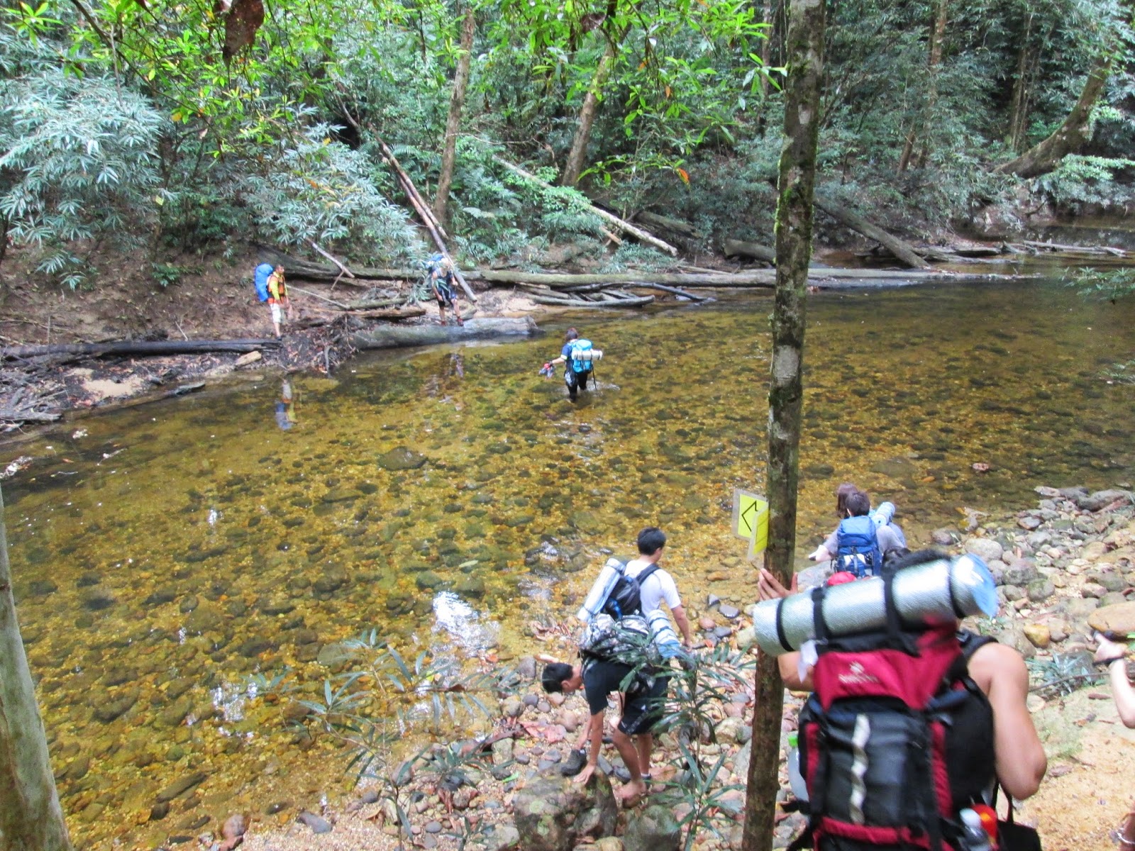 |
| River crossing |
 |
| Forest |
 |
| Camp Kor |
 |
| Reaching camp Kubang |
 |
| Hiking |
 |
| Settling at Camp Kubang |
 |
| Continue on to the peak |
 |
| Hiking onward to the peak |
 |
| Hikinf |
 |
| Almost at the top |
 |
| We made it!! |
 |
| At the top |
 |
| At the top |
 |
| At the top |
 |
| At the top |
Overall, this hike is one of my toughest hike yet. Do remember, able to climb Mt. Kinabalu doesn't mean Gunung Tahan can be conquer easily. But with enough training, it certainly can be done. The view on top here is spectacular and worth the climb. The trail via Merapoh is definitely easier than the trail via Kuala Tahan entrance which take around 7 days, so for those who want to enjoy the nature longer, Kuala Tahan trail would be nice. Trans-hiking from Merapoh to Kuala Tahan can also be done but transport have to be arranged accordingly. Last I heard, the trail via Kuala Tahan has a better view than Merapoh trail, but I will leave it here for you to decide.
The fastest I have gone for this mountain (during Mount Climbathon 2018)
Entrance to Camp Kor: 1hr 15mins
Camp Kor to Camp Kubang: 2hrs 30mins
Camp Kubang to Bonsai: 2hrs 00min
Bonsai to Tahan Peak: 1hr 30mins
Total Up: +- 7hrs 15mins
Last edited: 6/10/2014
No comments:
Post a Comment