Gunung Yong Yap - Gunung Bubu - Gunung Tok Nenek (YYBBTN) Dayhike / TNBYY

Distance: 42km(full route), 38km(Yong Yap single)
EG: 2,400m(full route)
Rated: 8.0/10 (full route), 7.5/10 (Yong Yap single)


Gunung Yong Yap, it is the sixth tallest mountain in Peninsular Malaysia or also known as G6. Though, most hiker will often do Gunung Bubu and Gunung Tok Nenek together which is known as Trans-YYBTN. Averagely, it take 3 days 2 night to complete the trails, but on 8/7/2018, we attempt to complete in under one days, daypack trip. The starting point of the trail head is at Loijing. 

To get here, first you need to GPS to this location (this is the turning point): "4.661016, 101.484274". The original trail head point is "4.6800500, 101.4688200" but I notice if you directly type in this location, they will sent you to a different turn point. Once you reach "4.661016, 101.484274", turn left at the road sign "Hutan Simpanan Kekal Loijing". The road to the trail head is OK, it was tar when we were entering toward the trailhead. 

Toilet are the surau in their kampung, there river there you can take bath at (if you manage to come out before dark), carpark is RM15/car, permit is required from the Department of Forest and guide is not compulsory but recommend to bring someone who familiar with the trail as there are a few junction... (you don't want to accidentally do Trans-V2 now, dont you....)

To the "Junction" from Monash University Malaysia


Turn Left here if you coming from Simpang Pulai or Cameron Highland
The road to the trail head of YYBTN


The entrance to YYBTN trail head

https://www.strava.com/activities/1689407284
GPX File Link:


With a full marathon distance, 42km in the jungle and an elevation of 2,900m, you can see why 3D2N is the more normal method of completing the mountain. The trail is actually quite welcoming with the first few km starting off on the 4WD and slowly convert into farmland trail, then to jungle trail. Also note, you going to have to cross a "million" river on this trip, so if you not prepared, your leg will be badly wrinkled. I applied Vaseline at the start of the hike and at the top of Yong Yap peak which did help prevent it from wrinkling too bad.

At the 6km mark, you will reach the first major junction which is the split between going Gunung Tok Nenek and Gunung Yong Yap, aka, Junction YY/TN. 

Before crossing the river, turn left go to Tok Nenek. Crossing the river, head straight, go to Yong Yap

The slope is steady upward from the start all the way to Camp Sungai Jerok, which is around the 14-15km mark. Please note that this is your last water point and you better refill here as the next water point is only after you complete all three peak and come down at Camp Belumut which is at that time pace, 7 hours of no water point (<< please note this is kinda averagely fast, it might take till 9 hours for some)

Your last water point!
From here onward, it a steep climb toward Gunung Yong Yap. Pass Camp Balak Pecah, we reach the Simpang YY/BB. From where you coming, turn left will bring you to Gunung Bubu straight and turning right will bring you up to Gunung Yong Yap.

And a steeper climb await ahead
After this simpang, going up Yong Yap here will be steep and fun, keep your hiking pole as you won't be needing them here. A short hike later will bring you to Yong Yap Peak, the first peak and the 6th tallest Peninsula Malaysia mountain. (18km/42km of your journey)!

Yong Yap Peak

Once coming down from the peak, you will reach back the junction. This time head straight toward Gunung Bubu. A series of up and down will bring you to Gunung Bubu which really isn't much here to see... It more like a camping spot for some up here. (23.5km/42km)!


Gunung Bubu

Continue on down and up for a few more km and you will reach Gunung Tok Nenek (also note, there a junction in between here that will bring you to Trans-V2 trails, take note at Puncak Kambing, don't turn right at that junction!!) The view up at Gunung Tok Nenek is the reason why you doing this Trans-YYBTN. The view here is spectacular and amazing! This spot was my longest resting time of all the "checkpoint". (27km/42km)!


After Gunung Tok Nenek, it all the way down toward the car park! Before that, stop at Camp Belumut to refill after the 7 hours of running out of water situation!

Water Point or Last Water Point if you coming from the other direction
After refilling and drinking straight from the river (no filter nor tablet though in my case), it was a downhill rush toward the car park, in my case, I was rushing to get back to the car park before dark! Along the way, there are plenty of camp site you can stop! Though, before you reach Simpang YY/TN (probably around the 33km mark? I could be wrong so take it with a pinch of salt as I was busy getting down), the trail here can be a bit confusing as some you have to walk along the river. It easy to get lost here in the dark so please take extra cautious here! Once you reach the junction YY/TN, turn right and shoot straight for the carpark!!




The time log for my hike is as following:

5.20am – Start Hike
6.25am – Camp Simpang YY/TN
8.00am – Camp Ages [5-10 min rest]
8.45am – Camp Sungai Jerok (Last Water Point) [5-10 min rest]
9.30am – Camp Balak Pecah
10.10am – Simpang YY/BB
10.35am – Yong Yap peak [15 min rest]
11.00am – Simpang YY/BB
12.50pm – Bubu Peak [5-10 min rest]
2.15pm – Puncak Kayung
2.30pm – Tok Nenek Peak [20 min rest] << Best View, take your time here
3.30pm – Camp Belumut (Water Point) [5-10 min rest]
4.00pm – Camp Hari
5.30pm – Camp Simpang YY/TN
6.35pm – Car Park

13 hours and 15 minutes for the whole journey including rest time. 42km around the jungle with close to 2,900m of elevation. Won't say it an easy hiking trail, but it certainly rewarding and fun in it own way! I really did enjoy the hike the whole way!.... ok, maybe except the part from Yong Yap to Bubu since I kinda know Bubu view is really nothing and I wasn't looking forward to it...

The time span during this trip for the group range from 12hrs30mins to 23hrs00mins, daypack Trans-YYBTN is not easy but it not impossible. Though, I would still think it might be easier if this was done in 3D2N!

Edit: 22 Jan 2019

On 19th January 2019, there was an event known as TNBYY Dayhike Challenge, it the same route but reverse as of the above. Fastest known time for finishing this route was recorded with the time record of 7hours22mins around the mountain.

I am able to manage to break the sub12 time span as follow:

7.00am - Start hike
7:55am - Simpang TN / YY
9:13am - Camp Hari
9:46am - Camp Belumut (LWP)
10:41am - Tok Nenek Peak (10 min rest)
11:00am - Puncak Kambing
12:20am - Bubu Peak (5 min rest)
1:45pm - Simpang YY / Bubu
2:15pm - Yong Yap Peak (5 min rest)
3:10pm - Camp Balak Pecah
3:35pm - Camp Sungai Jerok
4:20pm - Camp Agas
5:40pm - Simpang TN / YY
6:40pm - Car Park

(11 hours and 40 minutes)


Last Edited: 22 January 2019


Gunung Korbu and Gunung Gayong via Ulu Kinta SAS Dam

Distance: 32km for KorGA, 26km for Korbu only
Elevation Gain: 2,658m for KorGa, 2,100m+ for Korbu only

Gunung Korbu, 2183m, Peninsular Malaysia 2nd highest mountain or aka G2 and is only shorter to Gunung Tahan, 2187m by 4m though Korbu is easier than Gunung Tahan. But if you add in Gunung Gayung, the thing can get a bit tougher. 

The trail head is at "4.64957,101.24106" but the problem is you have to go through the dam gate which is at "4.668629, 101.198148" or Sultan Azlan Shah Dam(but this will bring you directly into the dam). So to enter KorGa (Korbu & Gayung), you need 2 permit, one from Forestry Department and one for the Dam Site. Also to note, the Dam gate only open at 9-10am, so early hike is usually quite impossible unless you are camping inside the day before.

The trail head don't have public facilities and car park space is limited, car pool is advised. Guide may not be compulsory but recommended as the river crossing inside the forest can be confusing for first timer. There a river at the side to wash-up but be-careful during dark as the river current is relatively fast.
SAS Dam Gate (If you notice the highest mountain shadow, yes, that Gunung Korbu)


Toward SAS Dam Gate


Going from SAS Dam Gate to Korbu Trailhead
https://www.strava.com/activities/2154305102
GPX File: https://www.dropbox.com/s/hzmjppe9q15pr2i/Korga_trail_head_to_ulu_kinta_dam.gpx?dl=0

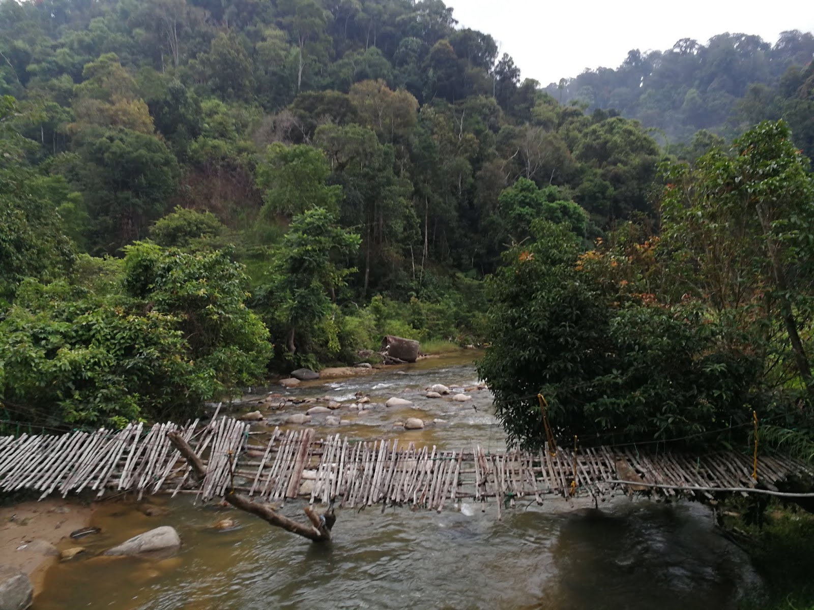
Take note of this bridge, turn onto the bridge to reach the trailhead
Korbu Trailhead


https://www.strava.com/activities/2154305422
GPX File: https://www.dropbox.com/s/nvcdt94aqslhxtb/KorGa.gpx?dl=0

Gunung Korbu only has a distance of 26km but it still a difficult mountain to conquer. The steepness gradient of this mountain is a killer. It usually take hiker up to 3-4 days, but there are very fit people out there who can complete this mountain under 10-12 hours.

The start of the hike can be already be quite steep, but the main issue with the start of the hike and before you reach the first camp site, Camp Seroja, there 6 river crossing and if your rock hopping skill is good, you won't get wet. I miss the first river but that is easy to cross, here the following 5 rivers... All of them had marker on when I was there but hopefully it stay on when you are visiting...

River no.2
River no.3 (Yes, over the tree log, if it still there...)

River no.4

River no.5 (part 1)

River no.5 (part 2)

River no.6
After river number 6, no more than 5 minutes walk will bring you to a junction, turning left here will bring you to the big log waterfall.

Big Log Waterfall
From trailhead to Big Log Waterfall may take you an hour and will take you another 1 hour to reach Camp Seroja.
Camp Seroja Layout

Camp Seroja


There river here on your left. After Camp Seroja, another hour of hiking will bring you to Camp Kijang but the campsite here is being damaged by landslide.

This river crossing is somewhere after 15minutes from Seroja
(Turning left bring you to empty land, going right and climb over the log go to Korbu)

Camp Kijang
Camp Kijang Layout

Once you reach Camp Kijang, take note of where you coming from as when you coming down here in the dark, the path is not as obvious as during the daylight. There a small river for you to refill here. After Camp Kijang, this is where the climb get very steep. It will take roughly an hour or more to reach the next checkpoint, Last Water Point.

Turn down to your right to refill water
Do make sure you refill your water here as there is no more water to refill after this. The next checkpoint is Botak though there is no signage here except a clear view of Korbu when there is no fog. After that is another hour to reach Korbu Peak. Do remember the climb does not stop from Camp Kijang, so you will be climbing most of the time at a steep gradient in this mountain. Halfway through, you will reach Cubaan, here is just a very steep wall where you climb 3 ladder in a row up to get over the wall.

Cubaan Wall
Overall, 6-7 hours for average hiker to reach Korbu Peak from trail head, 4-5 hours for the very fit climber. 

Korbu Peak, G2
Korbu Peak

(This entry after this will also be used for Trans-Titiwangsa V1 and V2)

Gunung Gayong, G4, Peninsular Malaysia 4th tallest mountain is not an easy mountain to reach. The easiest way to reach here is by climbing Gunung Korbu first, then climb here. There are other route which come from Yong Belar but that is known as the Trans-Titiwangsa route but it much tougher. 

Going toward Gunung Gayong

Gunung Korbu and Gayong are 3km apart but it still no easy task to get over the other side as the trail isn't easy to transverse plus the up and down gradient make it tougher, though in between the mountain are beautiful mossy forest and view of the Titiwangsa Mountain Range on a good day which can see Korbu, Gayong, Yong Yap, Bubu, Tok Nenek & Yong Belar. It take average of 1:30-2 hours one way to reach Gayong Peak, but fast one can do it in an hour time.

Do take note that there a junction close to Gayong Peak which is known as Simpang Proton. Usually when you see this junction, it mean you are 5 minutes to the peak, DO NOT turn left at the junction when you are heading to Gayong Peak as this will bring you into the wilderness known as Trans-Titiwangsa! 


Gayong Peak
Overall, it will take around 3-4 hours for a round trip from Korbu to Gayong peak. 

For KorGa dayhike, it may take some hiker up to 14-16 hours for very good pace hiker, 24 hours for some, and as mention, around 10-12 hours for the very fit climber.

My log time for the hike:
7:00am - Start Hike
8:30am - Camp Seroja
9:00am - Camp Kijang
9:50am - Last Water Point (rest 5min and refill)
11:10am - Korbu Peak (rest 15min)
12:25pm - Gayong Peak (rest 10min)
1:40pm - Korbu Peak (rest 15min)
3:00pm - Last Water Point (rest 5 min and refill)
3:45pm - Camp Kijang
5:50pm - End of Hike

Last Edited:
28 March 2019


Trans-Jerging (Mt. Suku >> Mt. Irau >> Mt. Yellow >> Mt. Pass) dayhike

Distance: 25km
EG: 2,000m
Rated: 6.5/10

Trans-Jerging Dayhike. Consists of climbing all four mountain in Cameron which are Suku-Irau-Yellow-Pass in the order. This trans-hike activity used to take two days but with the growing number of hiker turning into ultraman (ultra-marathoner), dayhike through Trans-Jerging is getting quite normal. This Trans-Hike is definitely not to be underestimated and remember, there is not turning back the moment you start your hike at Gunung Suku as your car will be situated the other end of the mountain. Thank to Hardcore Extreme Outdoor, Kray Chin and Kelly Ng for the guide!

We start our journey by first parking our car at "4.592698, 101.354465". The parking spot is not easy to miss in the day, but night time can be a little bit tricky.

As you notice from the picture below, there is no basic facility here but only river to wash yourself up. This hiking trail do require permit to hike but having a guide is not compulsory but recommended.

After you have park your car at the area, we all carpool with another car to the starting point of Trans-Jerging, "4.555596, 101.322949", also known as the starting of Gunung Suku (click on the link to find out about Suku car park spot and trail-head).
To the car park destination

Car park


https://www.strava.com/activities/1612289007

GPX File Link:
https://www.dropbox.com/s/wboeowefvsekyee/Trans_Jerging_Dayhike_Suku_Irau_Yellow_Pass_15_hours.gpx?dl=0
With around 25km and an elevation of 2000m+, on paper it may look like it slighly tougher than Gunung Nuang Hulu Langat which has an elevation of 1700m+ and 20km but do not let it fool you, the up and down of this hike and with a good number of climbing tree roots and deep mud pool, it make you wish you were at Gunung Nuang Hulu Langat. The trail here can be confusing and it really recommended you have someone familiar with the trail to take you with.

The start of the hike toward Gunung Suku is especially steep and it is here where it does take up most of your time, 3km out of 25km take average hiker 2.5-3 hours, fast one took less than 2 hours. Though, once you reach the Suku peak. you would have completed almost half of your elevation gain.

Gunung Suku (3.5km)
You will be able to see Gunung Yong Belar, Gunung Korbu and Gunung Gayung on clear day. After some rest, the journey of minimal up and down toward Camp Bear start but it also have a lot of tree root climbing, so hiking stick to be in the bag. After 1.5 hours of fast pace (probably 2hours+ for slower one), Camp Bear is here. Make sure you refill your water here to the max as there won't be anymore water source all the way to the end of the hike.

Camp Bear (7.5km)
After some rest and water refill, we head toward Gunung Irau. Half way through the journey, you will meet the infamous Trans-Jerging tree! Photo definitely need to be taken here!

Trans-Jerging Tree
For fast pace hiker, in 1hrs45minutes or probably 2hrs-3hrs for chill one will be able to reach the junction which turn left would continue toward Gunung Yellow and turning right will bring you to Gunung Irau which take around 30 minutes to and back (not counting photo time).

De Junction (10.5km)
Once lunching is done the de junction, we head on toward G. Yellow. Now even though you may be at the highest point of Trans-Jerging, the journey toward the end of the hike is not all downhill.. It will be a series of up and down and it kill those who are un-prepared! It also to note that from here, you will be working along the border of Perak and Pahang, so you will see plenty of border stone along the way, one of the sign that you are not lost...

Halfway through the journey, roughly 2 hours (less for fast, more for slow), you will reach once of the most amazing mossy forest in Cameron, the Secret Garden. It a little bit chilly here compare to the other part of the forest but this place is worth stopping for some photo!


After that, continue straight toward the Yellow Farm which is around 10-20 minutes only


This is one of the many "junction", which is why I recommend you to bring someone who familiar with the route...
Yellow Farm

Turn right then turn right! The a typo...

Gunung Yellow is only 10-20 minutes from Yellow Farm. Once here, we rest and had our small "dinner"...


Gunung Yellow (17.3km)
With less than 10km more to go, the journey toward Gunung Pass is also ain't that easy... In fact when we were traversing toward Gunung Pass, it remind me of hiking toward Pine Tree Hill or a lot of up and down!! After around 3 hours (less for fast and more for slow), we finally reach the junction of Pass!

Pass Junction (23.5km)
It just a 5 minutes hike toward Gunung Pass to officially complete your Trans-Jerging trip! After that, it a full 30 minutes downhill towards your car!!

Now do note that the above timing is all moving timing and I did not include any REST time! So it is possible to complete the whole hike within 12-14 hours! The whole Trans-Jerging journey is quite unique on it own but the trails is ain't as easy as on paper.

Be prepared before attempting this! Unless you some fast ass ultraman or hiker, than this Trans is consider kinda small compare to the other Trans-hike out there! (V1, Trans-Slim, YYBBTN and etc)


Last Edited: 14 July 2018